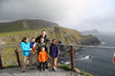
Photos > 2014 > 2014 Europe Trip Day 5 - Ireland (Church in Tralee, Blennerville Windmill, Dingle Peninsula, Conor Pass, Ventry Beach, Dunbeg Fort, Irish Potato Famine, Gallarus Oratory, Ring of Kerry, Valentia Island, The Kerry Cliffs, Ballinskelligs Castle and Beach) > IMG_1228 (Medium Size)
Next Photo
Previous PhotoPrevious Photo   
Next Photo
2014 Europe Trip Day 5 - Ireland (Church in Tralee, Blennerville Windmill, Dingle Peninsula, Conor Pass, Ventry Beach, Dunbeg Fort, Irish Potato Famine, Gallarus Oratory, Ring of Kerry, Valentia Island, The Kerry Cliffs, Ballinskelligs Castle and Beach)
Image 347 of 479
Click for Full Size Image
Next Photo
   Next PhotoNext Photo
Next Photo
GPS Location: Google Map
GPS Coordinate: 51.86962,-10.38775
GPS Altitude: 430 feet (above sea level)
Date Taken: Sunday, June 8th, 2014 - 06:28:45 PM
Filename: IMG_1228.jpg
Category: 2014 Europe Trip Day 5 - Ireland (Church in Tralee, Blennerville Windmill, Dingle Peninsula, Conor Pass, Ventry Beach, Dunbeg Fort, Irish Potato Famine, Gallarus Oratory, Ring of Kerry, Valentia Island, The Kerry Cliffs, Ballinskelligs Castle and Beach)
36053